| Recent Avalanches? | No |
| Collapsing (Whumphing)? | Yes |
| Cracking (Shooting cracks)? | No |
Observation: Turnagain
Location: Shark's Fin
We toured up to 1350′, right at the base of the main west-facing meadow. We dug a set of pits at 850′ and found weak layer of surface hoar buried about 18″ deep, just above a stout rain crust. We started noticing fresh wind slabs near the surface at around 1100′, and got a large collapse at 1350′. We dug a second round of pits to investigate, and found the same layer of buried surface hoar on top of a stout crust to be the culprit for the collapse. We decided not to keep going up the steep west-facing meadow.
Obvious signs of instability
Weather
Temperatures were in the low teens F, with light snowfall for most of the day. Winds were mostly calm, with an occasional breeze out of the southeast.
Snow surface
Crust up to 600'. 2-6" soft snow from 600-1100', with little to no wind effect. Fresh wind slabs and scoured surfaces above 1100'.
Snowpack
The weak layers in the upper 1.5' of the snowpack seemed to be more reactive today than they had on Eddie's, Tincan, Sunburst, or Pete's recently. The main layer of concern was a layer of surface hoar buried 1-1.5' deep, sitting on a stout rain crust (see photo). We got poor stability test results on this layer, and also got a large collapse on it once we stepped on a fresh wind slab. Both sets of pits (850' and 1350') were very similar. See snowpilot profile for more details.
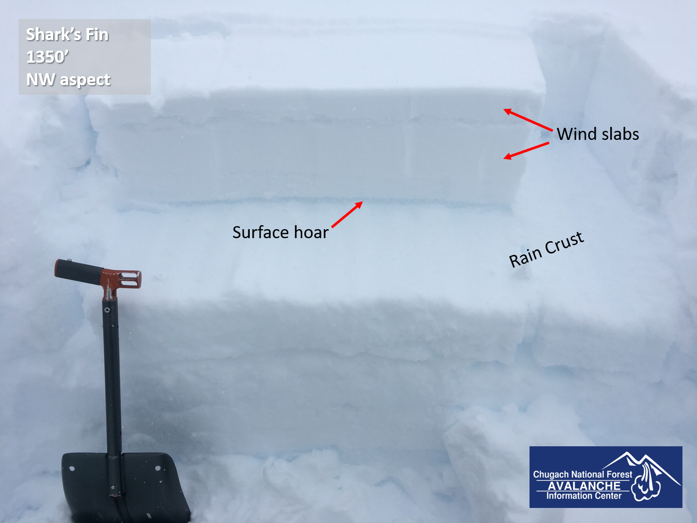
Snowpit on the slope that we got to collapse (NW aspect, 1350'). That layer of buried surface hoar on top of the 1/23 crust was the weak layer that collapsed. This slope had a fresh wind slab on the surface, and an older one buried about 4" deep. 02.20.2021

Buried 1/23 rain crust layer at 850' elevation. 02.20.2021

Looking south at Eddie's. The sun was trying to poke out briefly, but it was cloudy and lightly snowing all day. 02.20.2021
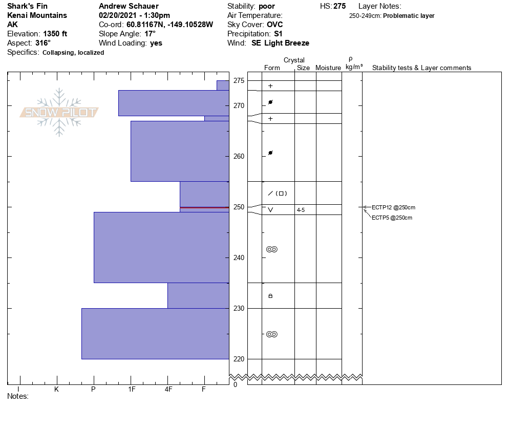
Snowpit profile from 1350'. The pits from 850' were very similar, with the exception of the wind slab on the surface.