| Trigger | Snowmachiner | Remote Trigger | Yes |
| Avalanche Type | Hard Slab | Aspect | Unknown |
| Elevation | 2300ft | Slope Angle | unknown |
| Crown Depth | 6ft | Width | unknown |
| Vertical Run | unknown |
Avalanche: Turnagain
Location: Seattle Ridge, 3rd Bowl, Rider Triggered Avalanches
Details below are from the two riders that remotely triggered three large to very large slabs in 3rd Bowl on the backside of Seattle Ridge on March 25th.
The riders entered 3rd Bowl from near the bottom, after passing through 2nd Bowl. They saw no signs the snow was unstable prior to the avalanches. They first saw the slab on the upper north face of the drainage release, then the slab across on the SW face. The debris from these two avalanches crossed and created a ridge. They took photos then headed back and that’s when they noticed the third and largest slab around the corner. This slab overran their previous tracks and sent debris into the drainages where 2nd and 3rd bowl come together.
Avalanche Details
Due to the reported timing of these slabs, it is most likely they all initiated from a collapse in the weak layer triggered by the riders. Essentially, one collapse created a domino effect that propagated up and down the drainage. This is extraordinary propagation of a weak layer that created avalanches on various aspects. The weak layer was faceted snow, formed in early March. It sits under 4-6' of settled snow that fell in mid March. The slab was between 3 and 8' deep depending on the degree of prior wind loading and scouring across the slopes. It is unknown the thickness of the weak layer itself.
The annotated topo image below is a general estimate of the avalanches and trigger point.
Weather
Sunny weather with breezy west winds. The snow surface was warming slightly but not to a large extent. Temps were in the 20'sF.
Snow surface
Soft settled powder with some wind effect in exposed areas from NW outflow winds the day before and earlier in the morning on the day of the avalanches.
Snowpack
4-6 feet of settled storm snow over a suspected mix of facets and sun crusts. There may have been weak snow under the buried sun crusts that helped the propagation in the faceted weak layer.
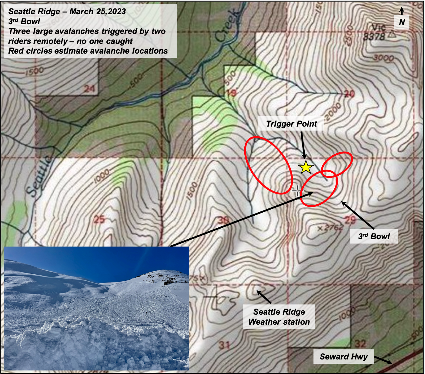
General overview of 3rd Bowl with estimated avalanches locations and trigger point.

Very large slab on the upper north aspect of 3rd Bowl.
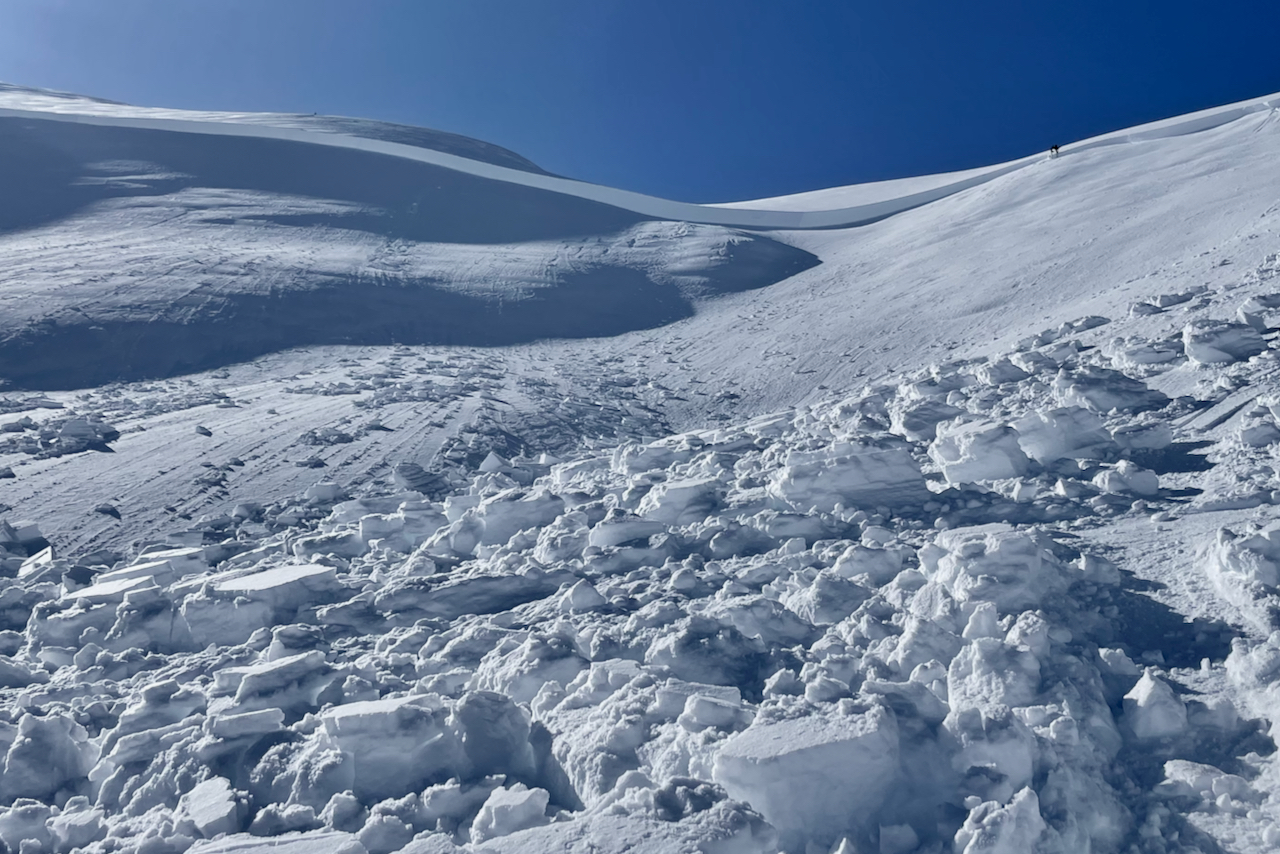
Deep section of crown in the avalanche above.
Avalanche that released last on the SW face of 3rd Bowl.

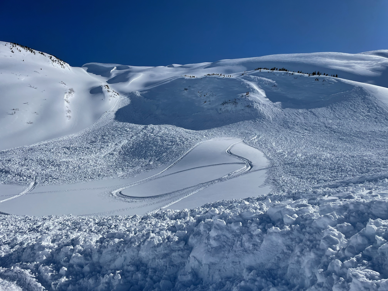
A look at both the avalanches on each side of the Bowl that are pictured above.

Avalanche lower in drainage on a NW aspect that covered riders previous tracks.

Another look at the lower portion of the slide that released lower down and covered the prior tracks.

Ariel view the following day of all three avalanches