| Trigger | Natural | Remote Trigger | No |
| Avalanche Type | Hard Slab | Aspect | West |
| Elevation | 1900ft | Slope Angle | 38deg |
| Crown Depth | 12in | Width | 250ft |
| Vertical Run | 300ft |
Avalanche: Turnagain
Location: Eddies
We skinned up to 2600′, digging pits at 1100′, 1900′, and 2550′. We found two buried persistent weak layers, both of which were reactive in stability tests. We checked out the natural avalanche on our way down, which we expect ran during the 2/11-2/12 wind event early in the morning of 2/12, more notes below.
Avalanche Details
The avalanche failed on a layer of facets buried about a foot deep on a wind-loaded slope, and quickly stepped down to a layer of surface hoar buried about 6" deeper. HS-N-R2-D1.5-O
Obvious signs of instability
| Recent Avalanches? | Yes |
| Collapsing (Whumphing)? | No |
| Cracking (Shooting cracks)? | No |
Observer Comments
No new avalanches observed but worth noting that we saw two avalanches that were attributed to the 2/11-2/12 wind event. One which we investigated and one that was on the south side of Eddies. The fresh debris pile was noticeable in the valley but the crown was out of sight.
Once out of the trees around 800' we experience multiple crust collapses, where the crust sits below facets and the recent wind affected snow, up to around 1200' when we skinned back into the trees.
Weather
Cloudy skies, with calm winds all day.
No precipitation.
Temperatures in the 20°Fs.
Snow surface
Soft snow at the lower elevations, which became more wind-affected as we went higher up. By the time we got near treeline we were starting to see anti-tracks and pencil-hard wind slabs on some slopes. There was a crust buried about 6" deep, which went up to around 1600'.
Snowpack
At all three elevations, we were finding two weak layers in the upper 2' of the snowpack. The shallower of the two was buried 6-10" deep, and was a combination of decomposing stellars and near-surface facets, with surface hoar at the top of the layer in some of the pits. The deeper weak layer was a layer of surface hoar buried 1.5-2' deep. These grains were pretty large (6-8 mm). We also found surface hoar on the snow surface, which disappeared around treeline.
Test results from the pits:
Pit 1 (1180', NW aspect)
ECTPV on the upper layer of surface hoar, 3-4" deep. In an another pit in a more wind-loaded spot at the same elevation the upper layer of surface hoar and facets was 30 cm down, CT4, CT6 and ECTP6. The lower layer of BSH (1cm) and nsf is on the melt-freeze crust crust 45cm down. CT11, CT9, ECTP10.
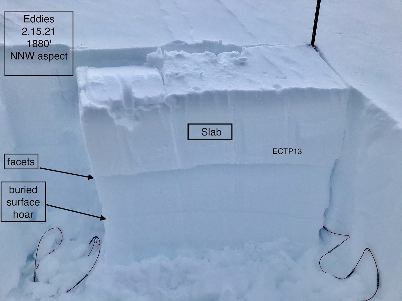
Pit 2 (1880', NNW aspect)
ECTP16, ECTP17 on a layer of stellars and near-surface facets about a foot deep.
Pit 3 (2550', NW aspect)
ECTP11 (x2) on the stellar/near-surface facet layer about 10" deep
ECTP21, CT14SC on the buried surface hoar, about 1.5' deep.
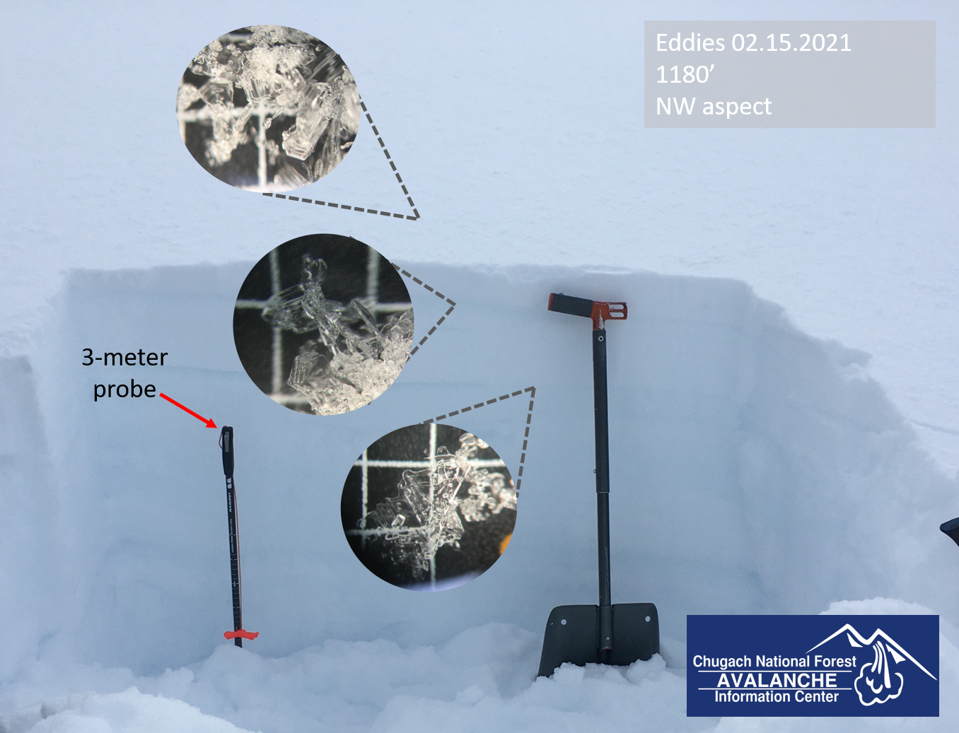
Two layers of buried surface hoar, plus a fresh layer on the surface just waiting to get buried. 02.15.2021
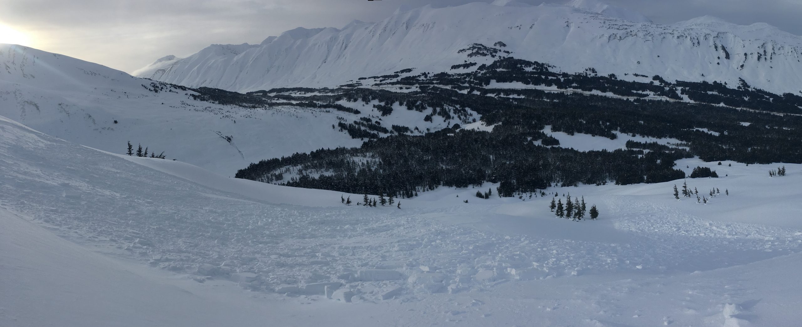
Looking down at the natural avalanche first observed on 02.12. The avalanche failed on the upper layer of buried surface hoar and near-surface facets, and quickly stepped down to the deeper surface hoar layer. 02.15.2021
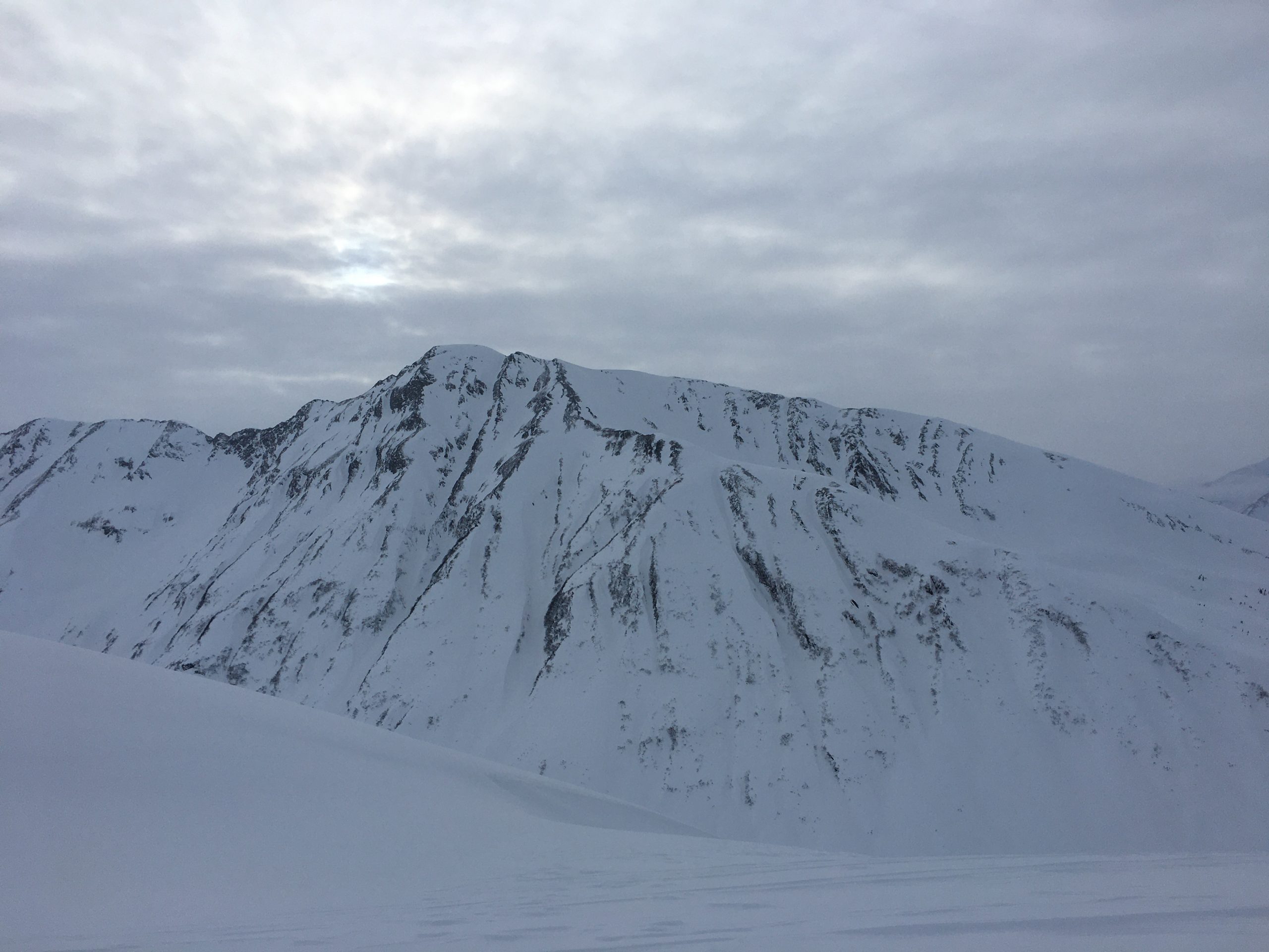
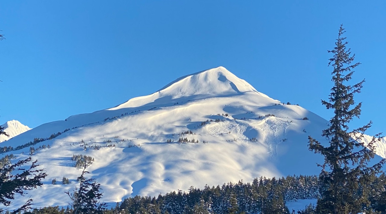
Looking at the north face of Tincan. Plenty of obvious scouring along the high points, cross-loading the gullies. 02.15.2021

The view at Portage this morning. 02.15.2021
Pit# 2 ECTP13
Wind triggered avalanche on Eddies, 2.12.21. Photo: George Creighton